Norway Launches Microsatellites built by Toronto’s Space Flight Laboratory – Space Daily

The Space Flight Laboratory (SFL) has announced the successful launch of two Norwegian microsatellites developed and built by SFL for the Norwegian Space Centre with support from the Norwegian Coastal Authority, Space Norway, and the European Space Agency. The Soyuz-2.1a rocket carrying the satellites into orbit launched from Baikonur at 06:36:49 UTC Friday 14 July 2017.

Shortly after launch both satellites were contacted from ground stations in Svalbard and Vardo, Norway. Both satellites are healthy based on initial telemetry, and commissioning is underway.

The first satellite, dubbed NORsat-1 carries a state-of-the-art Automatic Identification System (AIS) receiver to acquire messages from maritime vessels, a set of Langmuir probes to study space plasma characteristics, and a Compact Lightweight Absolute Radiometer (CLARA) to measure total solar irradiation and variations over time.

The payloads were provided by Kongsberg Seatex, the University of Oslo and the Physikalisch-Meterologisches Observatorium Davos World Radiation Center.

The satellite is approximately 15 kilograms with main body dimensions of 20x30x40cm. NORsat-1 utilizes SFL's Next-generation Earth Monitoring and Observation (NEMO) platform, and will serve the Norwegian Coastal Authority in monitoring maritime traffic while also performing ground breaking science.

The second satellite, NORsat-2 also carries an AIS receiver, but in addition has a VHF Data Exchange (VDE) payload that will enable higher bandwidth two-way communication with ships.

Both payloads were provided by Kongsberg Seatex. NORsat-2 will be the first satellite to provide VDE services to Norway. Adding VDE enables increased messaging capacity, better reliability of message delivery, and increased range of ship-to-shore and ship-to-ship communication beyond direct line of sight.

SFL's NEMO platform was used for NORsat-2, and the satellite was integrated in Toronto along with NORsat-1. The relatively large deployable Yagi antenna for the VDE payload was developed by SFL in collaboration with the University of Toronto's Electromagnetics Group.

With the rise of Ad Blockers, and Facebook - our traditional revenue sources via quality network advertising continues to decline. And unlike so many other news sites, we don't have a paywall - with those annoying usernames and passwords.

Our news coverage takes time and effort to publish 365 days a year.

If you find our news sites informative and useful then please consider becoming a regular supporter or for now make a one off contribution.

Read this article:

Norway Launches Microsatellites built by Toronto's Space Flight Laboratory - Space Daily

Farewell LISA Space Observatory Pathfinder put to sleep – NASASpaceflight.com

July 18, 2017 by Chris Bergin and William Graham

The Laser Interferometer Space Antenna (LISA) pathfinder mission has come to an end via the final commanding of the spacecraft. The 16 month mission, has provided the tools for a future mission that may take place probably not until the 2030s having successfully demonstrated the technology required to operate a space observatory tasked with studying gravitational waves. LISA Mission:

Conceived as a precursor mission to primary Laser Interferometer Space Antenna (LISA) which was to be a joint mission between ESA and NASA, LISA Pathfinder was designed to prove a concept which scientists believed would allow gravitational waves a phenomenon predicted by Albert Einsteins theory of General Relativity but which had previously not been proven to be observed by studying differences between perturbations in the orbit of a constellation of satellites.

NASA pulled out of the LISA mission due to funding challenges, placing the future mission in doubt. However, just last month, the primary mission received its clearance goal for the 2030s, and was approved as one of the main research missions of ESA. NASA continues to show some interest in being a minor partner.

LISA Pathfinders main experiment, the LISA Technology Package (LTP), contained two test masses, 4.6 centimeters (1.8 inch) cubes of a gold-platinum alloy, which were allowed to float freely in an environment with minimal gravitational interference.

As the masses moved within the spacecraft, LTP used a laser interferometer to identify changes of position on the order of picometers.

Early in 2016, a brief test of drag-free conditions was achieved, applying no electrostatic potential along the cubes sensitive axes to control their position. The spacecraft was maneuvered around the cubes, keeping it centered around one.

NASAs Disturbance Reduction System (DRS), a system of miniature thrusters generating an impulse on the order of micronewtons were used by the spacecraft to maintain its position relative to the free-floating masses.

These thrusters controlled the spacecrafts position to the degree of nanometers.

DRS was originally developed by NASA as part of the New Millennium program, under the designation Space Technology 7 (ST-7).

LISA Pathfinders experiment was designed to validate the spacecraft could accurately measure the movements of these test masses and maneuver accordingly. It was a scaled-down form of the experiment that would have been flown by LISA, using two masses within the same spacecraft instead of three masses in separate spacecraft orbiting at great distances.

LISA Pathfinder was originally to have been part of the Small Missions for Advanced Research in Technology (SMART) program, designated SMART-2. It would have been the second such mission, after the SMART-1 mission which orbited the Moon between 2004 and 2006.

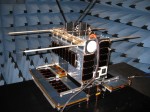
The LISA Pathfinder spacecraft is a 1,906-kilogram (4,202 lb) vehicle consisting of separable propulsion and experiment modules. It was launched on Arianespaces Vega rocket in December, 2015.

Upon the spacecraft reaching its operational halo orbit around the Earth-Sun L1 Lagrangian point, the propulsion module separated and maneuvered away from the experiment module.

In a 500,000 by 800,000 kilometer (300,000 by 500,000 mile) orbit around the Lagrangian Point, the spacecraft was set to operate for around half a year spending three months testing the LISA Technology Package, two months testing the Disturbance Reduction System and then finally a month operating the two systems together.

However, with the mission proceeding without issue and exceeding expectations a further extension to the mission timeline was granted.

The final experiment pushed the precision limits of the test mass grabbing and releasing mechanisms. Then, after a series of final operational tests, the last commands were sent to shut down the spacecraft.

While official operations ended on June 30, the spacecraft team uploaded commands to disable A Computer on Monday, with the final command to completely end the mission occurring on Tuesday.

On 18 July, the LPF mission will conclude with the final commands sent to switch off the on-board transmitter. Since April, the mission operations team in Darmstadt have been working to ensure a safe and smooth end-of-life for this fantastic technology demonstration spacecraft, noted ESA.

The final command was sent just prior to 6pm UTC.

For disposal, the spacecraft has already performed a de-orbit maneuver to leave its Lagrangian orbit and start to drift ahead of the Earth in a heliocentric orbit around the Sun.

The spacecraft now has an orbital period a few days shorter than that of the Earth, keeping the spacecraft safely out of the way and drifting serenely around the Sun, ESA added.

Airbus Defence and Space constructed LISA Pathfinder, using a custom bus for the mission. The propulsion module was loosely derived from the Eurostar 2000 bus used for geostationary communications satellites, utilizing liquid propellant.

The experiment module accounted for about 480 kilograms (1,058 lb) of the spacecrafts mass with the propulsion module accounting for the rest. Power was provided by a panel of solar cells mounted atop the experiment module.

The follow on LISA mission will consist of three spacecraft in a triangular formation, each 2.5 million kilometers from the other two in an orbit around the sun trailing the Earth. The spacecraft would shine lasers at each other, with interferometers on each spacecraft detecting minute distance changes caused by passing gravitational waves.

The three spacecraft, with a combined mass of about 6,000 kilograms, including payload adapter, would launch on an Ariane 6 and drift to their planned orbit over the course of a year and a half.

LISA is to have a planned mission lifetime of four years, but with sufficient propellant on each spacecraft to operate for up to a decade.

(Images via ESA).

Read the original here:

Farewell LISA Space Observatory Pathfinder put to sleep - NASASpaceflight.com

Small fire extinguished at SpaceX building in Port Canaveral – SpaceFlight Insider

Jerome Strach

July 17th, 2017

On July 16, 2017, a SpaceX building at Port Canaveral was reported to have had a fire on its rooftop. The small fire was quickly extinguished by firefighters. Photo Credit: Google Maps

Brevard County firefighters responded to a fire located at the recently-leased SpaceX building at Magellan Road and Grouper Road next to Port Canaveral. The fire was reported by a passer-by at 4:45 p.m. EDT (20:45 GMT) July 16, 2017.

Several minutes later, numerous fire units responded to the location along with support ambulances and Brevard County sheriff deputies. The building was found to have a rooftop fire, which was easily accessed by a ladder truck and was extinguished, according to Florida Today, by 8 p.m. EDT (00:00 GMT July 17).

Brevard County Fire Rescue found the structure to be unoccupied at the time of arrival, and Brevard County Sheriffs Office Public Information Officer Tod Goodyear confirmed no evacuation was required. The only injury reported was a firefighter that suffered from a heat stress related injury and was transported to a local hospital by ambulance.

Captain Brian Dennison of the Cape Canaveral Fire Department told SpaceFlight Insider the fire occurred where contractors were doing some refurbishment to the building. SpaceX has been leasing the building since March 2017.

SpaceXs contractors were doing the work, and that would have been either Thursdayor Friday this past week, Dennison said. At this point were still unsure of a cause and an origin of the fire, but it was in the area of where they were doing work on the roof.

The building will remain under the control of the Cape Canaveral Fire Department until the Florida State Fire Marshal arrives on scene to begin its investigation. Dennison said SpaceX personnel are also on site and prepared to begin anywater damage mitigation that might be required.

SpaceXs John Taylor, tweeted out gratitude for the quick response by BrevardCounty Fire Rescue and Cape Canaveral Fire Rescue. He said there was no damage to any SpaceX equipment or hardware.

Tagged: Brevard County Fire Rescue Cape Canaveral Lead Stories Port Canaveral SpaceX

Jerome Strach has worked within the Silicon Valley community for 20 years including software entertainment and film. Along with experience in software engineering, quality assurance, and middle management, he has long been a fan of aerospace and entities within that industry. A voracious reader, a model builder, and student of photography and flight training, most of his spare time can be found focused on launch events and technology advancements including custom mobile app development. Best memory as a child is building and flying Estes rockets with my father. @Romn8tr

Original post:

Small fire extinguished at SpaceX building in Port Canaveral - SpaceFlight Insider

Get to know 4 private spaceflight companies that could be the future – Mashable


Mashable
Get to know 4 private spaceflight companies that could be the future
Mashable
Almost any space nerd will tell you that the future of the space industry hinges upon private spaceflight. Of course, almost anyone with an interest in tech and ...
Commercial spaceflight company reveals plans for lunar outpostThe Space Reporter

all 5 news articles »

More:

Get to know 4 private spaceflight companies that could be the future - Mashable

ShareSpace Apollo 11 Gala held under KSCVC’s Saturn V – SpaceFlight Insider

SpaceFlight Insider

July 16th, 2017

From left to right, Buzz Aldrin, Jeff Bezos, Harrison Schmitt, Michael Collins, and Walt Cunningham at the 2017 Apollo 11 ShareSpace Foundation Gala. Photo Credit: Tom Cross / SpaceFlight Insider

KENNEDY SPACE CENTER, Fla. Under one of the three surviving Saturn V Moon rockets, Buzz Aldrins ShareSpace Foundation hosted a gala and auction in honor of mankinds first footsteps on another world on Saturday, July 15, 2017.

Aldrin was joined by fellow Apollo 11 astronaut Michael Collins, Walt Cunningham (Apollo 7), Jack Schmitt (Apollo 17), as well as former space shuttle astronauts Mae Jemison (STS-47), Winston Scott (STS-72 and STS-87) and Terry Virts (STS-130 and Soyuz TMA-15M), as well as NewSpace entrepreneur Jeff Bezos.

The event was held just five days prior to the 48th anniversary of the Apollo 11 Moon landing that saw Aldrin and Neil Armstrong become the first humans to set foot on Earths closest celestial neighbor, the Moon. The duotouched down on the Moons Sea of Tranquility (Mare Tranquillitatis) on July 20, 1969, the first of six crewed landings on the lunar surface.

The ShareSpace Foundation is a nonprofit organization formed to encourage young people to pursue careers in S.T.E.A.M. (Science, Technology, Engineering, the Arts and Math). Aldrin conveyed these statements in the days leading up to this weekends gala.

As we approach the 50thanniversary of the Moon Landing, its my ultimate ambition to lay the foundations that will inspire and support the next generation to become space pioneers. I passionately believe that we can land people on Mars by 2040. To do this we need to provide our future space pioneers with the right educational tools and motivation and we need the funding to do so, Aldrin stated via a release. By attending the event, guests are invited to play a historical role in the advancement of Mars exploration by sharing our vision and supporting our ambitions. Humanity needs to explore, to push beyond current limits, just like we did in 1969. I want to do everything I can to lay the groundwork.

All profits from ticket sales as well as other fundraising efforts went to the non-profit ShareSpace Foundation.

Tagged: Apollo 11 Buzz Aldrin's ShareSpace Foundation Kennedy Space Center Visitor Complex Saturn V The Range

SpaceFlight Insider is a space journal working to break the pattern of bias prevalent among other media outlets. Working off a budget acquired through sponsors and advertisers, SpaceFlight Insider has rapidly become one of the premier space news outlets currently in operation. SFI works almost exclusively with the assistance of volunteers.

Read the rest here:

ShareSpace Apollo 11 Gala held under KSCVC's Saturn V - SpaceFlight Insider

Norway Orbits Microsatellites Built by Toronto’s Space Flight Laboratory – Satellite Today

Soyuz 2.1a a moment after launch on July 14. Photo: Roscosmos.

The Space Flight Laboratory (SFL) announced the successful launch of two Norwegian microsatellites developed and built by SFL for the Norwegian Space Center with support from the Norwegian Coastal Authority, Space Norway, and the European Space Agency (ESA). The Soyuz 2.1a rocket carrying the two satellites launched from Baikonur on Friday, July 14, and also carried payloads for Planet, Astro Digital, Spire, and GeoOptics.

Shortly after launch both Norweigian satellites made contact with ground stations in Svalbard and Vardo, Norway. Both satellites are healthy based on initial telemetry, and commissioning is underway.

The first satellite, dubbed NORsat 1, carries an Automatic Identification System (AIS) receiver to acquire messages from maritime vessels, a set of Langmuir probes to study space plasma characteristics, and a Compact Lightweight Absolute Radiometer (CLARA) to measure total solar irradiation and variations over time. Kongsberg Seatex, the University of Oslo and the Physikalisch-Meterologisches Observatorium Davos World Radiation Center provided the payloads.

The second satellite, NORsat 2, also carries an AIS receiver, but in addition has a Very High Frequency Data Exchange (VDE) payload that will enable higher bandwidth two-way communication with ships. Kongsberg Seatex provided both payloads. According to SFL, NORsat 2 will be the first satellite to provide VDE services to Norway. Adding VDE enables increased messaging capacity, better reliability of message delivery, and increased range of ship-to-shore and ship-to-ship communication beyond direct line of sight, according to the company.

SFL used its NEMO platform for NORsat 2, and the satellite was integrated in Toronto along with NORsat 1. SFL developed the relatively large deployable Yagi antenna for the VDE payload in collaboration with the University of Torontos Electromagnetics Group.

Read the original post:

Norway Orbits Microsatellites Built by Toronto's Space Flight Laboratory - Satellite Today

TDRS-M launch date under review following pre-launch incident – NASASpaceflight.com

July 17, 2017 by Chris Bergin and William Graham

NASA and Boeing are reviewing the status of the TDRS-M launch date following an incident relating to an antennaduring the spacecrafts final launch processing to launch. The spacecrafts launch atop United Launch Alliances Atlas V rocket is currently scheduled to take place on August 3.

TDRS-M:

A flagship launch of the third of the latest generation ofTracking and Data Relay Satellites (TDRS) is facing a review following an incident during closeout processing.

The spacecraft has been preparing for an August launch inside the Astrotech Space Operations facility in Titusville, Florida.

No specifics about the July 14 incident have been provided, with a NASA statement only noting the assessments surround the spacecrafts Omni S-band antenna.

NASA and Boeing are reviewing an incident that occurred during final spacecraft closeout activities, NASA said. The mission team is developing a plan to assess flight acceptance and the schedule forward.

These additional activities are under evaluation for a planned TDRS-M launch Aug. 3, 2017, on an Atlas V rocket from Cape Canaveral Air Force Station in Florida.

It is understood this latest incident is not related to a close call that NASA was investigating earlier in the flow. That incident involved the spacecrafts shipping container containing environmental instrumentation which slid a couple of feet on the trailer it was being winched on to.

The processing flow for the mission had already passed several review milestones, specifically the Launch Vehicle Readiness Review (LVRR), Safety and Mission Success Review (SMSR) and the Calibration & Recertification Review (CRR).

The Atlas V that will provide the spacecraft with its ride to orbit is currently being integrated inside the Vertical Integration Facility (VIF) at Space Launch Complex -41 (SLC-41). ULAs flow with the rocket has continued without issue, with the TDRS issue unrelated and upstream to their operations.

The next key milestones in the flow are the Atlas V/TDRS-M MORR (Mission Operations Readiness Review), TDRS-M FRR (Flight Readiness Review) anda final status review, the latter set to take place on July 28.

This will clear the way for Atlas V to launch with TDRS-M on August 3, in a window ranging from 09:02 to 09:42 Eastern, pending the recent incident hasnt caused a delay to the launch date.

The mission will be the 13th spacecraft in NASAs Tracking and Data Relay Satellite System (TDRSS), with TDRS-M becoming the final spacecraft in the set of three third-generation satellites.

The new range are 3,454 kilogram (7,615 lb) satellites which have been manufactured by Boeing and based around the BSS-601 satellite bus.

They have a design life of 15 years. However, todatemost TDRS satellites have significantly exceeded their design expectations. The satellite carries an R-4D-11-300 apogee motor to raise itself into its final orbit and carry out othermaneuvers.

TDRS-M is powered by solar panels, generating between 2.8 and 3.2 kilowatts of power depending on illumination.

The satellite carriess-bandphased array antennae to allow simultaneous communications with five other spacecraft, as well as two steerable antennae providing S, Ku or Ka band coverage to spacecraft requiring communications at a higher data rate. Its this system that is currently being reviewed due to the incident noted by NASA over the weekend.

History of TDRS:

TDRS satellites are used by NASA to provide communications links between spacecraft in orbit includingthe International Space StationandHubble Space Telescope and ground controllers. Part of NASAs Space Network, TDRSS was implemented to reduce NASAs dependence on ground stations and airborne tracking assets.

Use of the network is not restricted to NASA missions; amongst other users United Launch Alliance and others use TDRS to relay data from their rockets during launch, JAXA and the European Space Agency have used TDRS for missions, including HTV and ATV flights to the ISS, and the system is rumoured to be used by the National Reconnaissance Office to supplement its own Satellite Data System, transmitting data from reconnaissance satellites for analysis.

Older satellites in more highly-inclined orbits have been used to relay communications to the AmundsenScott Station at the South Pole; a site not usually accessible to communications satellites due to its extreme latitude.

First-generation TDRS satellites were deployed from the Space Shuttle, with an Inertial Upper Stage used to raise them into geostationary orbit. These spacecraft, whichwerebuilt by TRW, were designed for a seven-to-ten year service life.

The first TDRS satellite TDRS-1 was deployedduring STS-6, the maiden flight of Challenger, in April 1983.

During the launch ofTDRS-1the Inertial Upper Stage malfunctioned. A two-stage solid-fuelled vehicle, the first stage of the IUS performed nominally however during the second stage burn control of the vehicle was lost.

The satellite was deployed into an orbit with a perigee approximately 13,000kilometers(8,000 mi, 7,000nmi) below geosynchronous orbit, with its period five and three-quarter hours shorter than expected.

Despite this partialfailurethe satellite was able to recover to its operational orbit, making a series of firings with itsmaneuveringthrusters which gradually raised the perigee over the period of several months. TDRS-1 exceeded its design life almost four times over, finally being decommissioned in June 2010 after its final amplifier failed.

Following the malfunction during the TDRS-1 launch and anomalies on several other flights, concerns over the reliability of the IUS resulted in knock-on delays for the TDRSSprogram. STS-12, which had been slated to deploy the second satellite, TDRS-B,was canceled and the payload reassigned to STS-51-E.

Challenger was rolled out to Launch Complex 39A in February 1985;howevera faulty timer in the TDRS satellite forced NASA torollbackanddestackthe orbiter. STS-51-E wascanceled, withChallenger flying the STS-51-B mission instead.

TDRS-B was finally ready to fly in early 1986, as the primary payload of STS-51-L. Launched on 28 January,Challenger disintegrated 73 seconds later with the loss of her crew and payload.

As a result of the failure, the designation TDRS-2, which would have been given to TDRS-B upon the completion of initial on-orbit testing, was never assigned typically for a program with separate launch and on-orbit designations in the event of a launch failure the on-orbit designation is reassigned to the next successful mission to avoid gaps in the sequence.

When Space Shuttle missions resumed in 1988,TDRS-3 was the primary payload for the return-to-flight mission, STS-26, flown by Discovery. TDRS-3 remainsoperable,and is located at 49 degrees west as a reserve satellite.STS-29, also flown by Discovery, successfully deployed TDRS-4which operated until late 2011 and was decommissioned in March 2012.

TDRS-5 was deployed by Atlantis during STS-43, withEndeavour launching TDRS-6 during STS-54; these two spacecraft, the last from the original order, remain in operation located at 161 degrees west and 62 degrees west.

The last first-generation satellite, TDRS-7, was ordered as a replacement for TDRS-B and incorporates some enhancements over the other satellites, while still being based on the same TRW bus.

It was deployed by STS-70 in1995,and remains in operation at 85 degrees East (275 degrees West) as TDRS-Z, covering the so-called Zone of Exclusion between the operational West and East satellites; TDRS-9 and TDRS-10.

Three second-generation TDRS satellites were built by Hughes Space and Communication, later part of Boeing, and launched between 2000 and 2002. These BSS-601-based spacecraft were launched by Atlas IIA rockets.

TDRS-8 was found to have a defective antenna, resulting in reduced performance compared to expectations before launch.

The TDRS-9 and 10 spacecraft suffered from the same fault, however as a result of the problem with TDRS-8 it could be found and corrected while they were still on the ground.

TDRS-9 also suffered from apressurizationproblem in its propulsion system, which resulted in it taking six months to reach its operational orbit. TDRS-9 and 10 are located at 41 degrees and 174 degrees west as the operational TDRS-East and TDRS-West satellites respectively. TDRS-8 is located at 89 degrees east (271 degrees West).

The first two third-generation satellites were ordered in December 2007, with the contract including options for NASA to order two further spacecraft. TDRS-11, known as TDRS-K at the time of launch, was the first third-generation satellite to fly riding an Atlas V into orbit.

TDRS-L, the second of the original two orders, while one of the options was exercised in late 2011 at a cost of $289 million. That satellite, TDRS-M, is the one to be launched next.

The three primary satellites in the constellation are the TDRS-East, TDRS-West and TDRS-Z satellites;howeverall of the operable spacecraft aside from TDRS-3 are in operational use.

(Images via NASA, ULA, Boeing and L2 Historical.To join L2, click here:https://www.nasaspaceflight.com/l2/)

See more here:

TDRS-M launch date under review following pre-launch incident - NASASpaceflight.com

AIDA mission to validate crucial asteroid deflection technology – SpaceFlight Insider

Tomasz Nowakowski

July 16th, 2017

ESAs Asteroid Impact Mission is joined by two triple-unit CubeSats to observe the impact of the NASA-led Demonstration of Autonomous Rendezvous Technology (DART) probe with the secondary Didymos asteroid, planned for late 2022. Image & Caption Credit: ESA / ScienceOffice.org

While there is currently no imminent asteroid threat and none of the known near-Earth objects (NEOs) is on collision course with our planet, humanity should be prepared for the worst. With that thought in mind, NASA and ESA are developing the Asteroid Impact and Deflection Assessment (AIDA) mission; its main goal is to demonstrate the kinetic impact technique that could change the motion of a potentially hazardous asteroid.

The AIDA mission will consist of two spacecraft sent to the binary asteroid called 65803 Didymos. Built by ESA, the Asteroid Impact Mission (AIM) will be launched in October 2020 and is expected to be injected into the orbit of the larger asteroid. NASAs contribution to this endeavor, the Double Asteroid Redirection Test (DART), will be launched into space nearly one year later and slated to crash into the smaller asteroid in October 2022. AIM will be just in place to observe the impact and study its aftermath.

This mission, in partnership with ESA and NASA, will allow us to validate the technology of the kinetic impactor and also to improve our understanding of threatening asteroids, Patrick Michel, AIM/AIDA investigator at the Cte dAzur Observatory (OCA), told Astrowatch.net.

LEFT: Artists rendering of ESAs desk-sized Asteroid Impact Mission (AIM). Image Credit: ESA Science Office. RIGHT: Artists rendering of NASAs Demonstration of Autonomous Rendezvous Technology (DART) spacecraft. Image Credit: NASA

Therefore, the mission would be essential for the most one of the most important asteroid deflection technology the kinetic impactor. In particular, AIDA will demonstrate the feasibility of this technique based on the data gathered by observing DARTs crash into Didymos moon with a velocity of about six km/s. AIM will orbit the asteroid in order to perform detailed before-and-after observations of the structure of the space rock itself, as well as its orbit, to thoroughly characterize the kinetic impact and the consequences.

To make sure a technique is valid and that we know how to use it, we need a test. Otherwise, we can talk, but it will remain on paper and we cannot guarantee anything. And this is why we still push for the AIDA space mission to happen, Michel said.

He noted that the success of AIDA will have many implications for planetary defense, science, and asteroid mining because the knowledge needed for these three aims is essentially the same. According to Michel, it will prove that asteroids are the only natural risk that we can predict and prevent by making the necessary steps.

AIDA, if done, will accomplish the step that will allow us to tell the future generations: we did our duty, we have now a validated tool to prevent the risk! And it will also come with science and technology returns, which contributes to [inspiring] young generations, Michel noted.

The AIM spacecraft is still in its conceptual phase. When it comes to DART, the probe was recently moved by NASA from concept development to preliminary design phase.

Tagged: AIDA AIM Asteroid Didymos DART NASA The Range

Tomasz Nowakowski is the owner of Astro Watch, one of the premier astronomy and science-related blogs on the internet. Nowakowski reached out to SpaceFlight Insider in an effort to have the two space-related websites collaborate. Nowakowski's generous offer was gratefully received with the two organizations now working to better relay important developments as they pertain to space exploration.

Follow this link:

AIDA mission to validate crucial asteroid deflection technology - SpaceFlight Insider

TDRS-M spacecraft damaged during closeout activities – SpaceFlight Insider

Jason Rhian

July 16th, 2017

An incident with NASAs TDRS-M occurred during closeout activities on Friday, July 14. Photo Credit: Vikash Mahadeo / SpaceFlight Insider

TITUSVILLE, Fla. During closeout activities for the final third-generation Tracking and Data Relay Satellite (TDRS-M), an incident occurred to the spacecrafts Omni S-band antenna. This occurred on Friday, July 14, about two-and-a-half weeks prior to the satellites scheduled launch.

Both NASA and the satellites manufacturer, Boeing, are reviewing what happened at theAstrotech Space Operations building in Titusville, Florida, where the satellite was being readied for flight.

TDRS-M, which will be renamed TDRS-13 upon reaching orbit, was set to launch atop a United Launch Alliance Atlas V 401 rocket from Cape Canaveral Air Force Stations Space Launch Complex 41 in Florida on August 3.

At present, it is unclear if this incident will impact the planned launch date with a recent statement on NASAs TDRS-M Status Update page noting: The mission team is developing a plan to assess flight acceptance and the schedule forward.

Tagged: Boeing Lead Stories NASA TDRS-M Urgent

Jason Rhian spent several years honing his skills with internships at NASA, the National Space Society and other organizations. He has provided content for outlets such as: Aviation Week & Space Technology, Space.com, The Mars Society and Universe Today.

Go here to read the rest:

TDRS-M spacecraft damaged during closeout activities - SpaceFlight Insider

Jupiter images thrill, inspire public participation – Spaceflight Now

STORY WRITTEN FORCBS NEWS& USED WITH PERMISSION

Processing images from the camera aboard NASAs Juno spacecraft orbiting Jupiter has turned into a cottage industry of sorts, as rank amateurs, accomplished artists and experienced researchers turn relatively drab raw images into shots ranging from whimsical to spectacular and everything in between.

The question is, how accurately do they reflect reality, and is there any way for the casual observer to judge the result?

Unlike other NASA spacecraft, the JunoCam imager aboard the Juno spacecraft was added to the mission primarily for public outreach. Its pictures have no bearing on the missions scientific objectives, which rely on a suite of eight other instruments to study Jupiters interior structure, its gravity and magnetic fields and its immediate environment.

JunoCams images are only lightly processed by the cameras builder Malin Space Science Systems of San Diego and immediately posted on line. What happens after that is up to the public.

Once its in their hands, we have no control, nor do we want to exert any, over what they do with the data, said Candy Hansen, a senior scientist at the Planetary Science Institute and the JunoCam instrument lead. So we have gotten everything from careful scientific-type processing to incredibly whimsical works of art. So its a little bit, for you, a buyer-beware situation.

Even so, she said, were all in, in the sense that I dont have a team of scientists and image processors waiting in the wings in case the public doesnt show up. We dont have a budget, we dont have staff or anything like that. So we are entirely, 100 percent, relying on the public. And some of them have done fabulous work.

Juno is the first spacecraft to be sent into an orbit around Jupiters poles, and JunoCam was designed primarily to capture detailed images of the planets heretofore unseen polar regions.

Because of weight, volume and power restrictions, the spacecraft could not support an advanced telescopic camera. Instead, it was equipped with a relatively simple imager with what amounts to a fish-eye lens. Malin Space Science Systems provided a similar camera to photograph the Curiosity rovers descent to Mars.

While JunoCam is not as powerful as the sophisticated telescopes and sensors launched aboard other NASA probes, Junos elliptical orbit carries it closer to Jupiter than any other spacecraft, within a few thousand miles of the giant planets cloud tops. As a result, JunoCams wide-angle views provide exceptional detail and more context than more powerful narrow-angle instruments.

But how realistic are the publics interpretations of JunoCam images? With other NASA spacecraft, the viewer can have confidence the photos were processed and reviewed by scientifically competent team members and that the images reflect some sort of scientific reality.

With public processing, as Hansen said, its more a case of buyer beware, and the relatively bland raw images lend themselves to Photoshop-type manipulation. To Hansen, the line between a scientifically accurate image and one that takes liberties with the data is the minute you depart from true color.

The minute you start making the blue a little bluer and the red a little redder, now youve enhanced the color. And when you really go to the sort of wild ends of the color palette, then I would call it exaggerated. If youre just plain making up things, then its false color.

So should viewers wanting to learn more about Jupiter prefer realistic lighting and color to enhanced or exaggerated images?

Let me argue against that, she said. Our human eye-brain combination is better at seeing details that are there when you exaggerate it a bit, when you enhance it a bit. The details, you can see (them) if you know what youre looking for in the true color images. But its so subtle, its really, like, washed out. I would say we learn a lot by looking at enhanced color images because it pops more to the eye-brain combo.

Raw images from JunoCam are posted on a website Hansen helps manage. Each raw image includes the same view shot in green, blue and red filters and then a slightly processed color view that is a combination of all three. The public can download those images, process them in a wide variety of ways and upload the results back to the website.

As long as the processed images relate to Jupiter, and dont contain unrelated or objectionable material, they are re-posted and available for anyone to download. All are in the public domain, although uploaders can opt to restrict commercial usage.

Hansen cited several processors for their work, including Bjrn Jnsson, who she said goes to great lengths to ensure realistic lighting and color, and Sen Doran, a graphic artist whose enhanced images are incredibly beautiful, they are drop-dead gorgeous.

Gerald Eichstdt, a mathematician and software developer, devised code to ensure uniform lighting across an image, Hansen said, adding Im urging him to write up an actual science paper and get some credit for all that work, at least in the scientific community.

In an email exchange with CBS News, Doran said his images are based on Eichstdts work, adding my aim is to provide an aesthetic enhancement to what he has done.

I use a range of techniques in Photoshop to extract detail and enhance subtleties in the source image, he wrote. This can develop into quite a large set of actions and layers each with different non-destructive adjustments and masks. These layers are treated with various blend modes to provide finer control in mixing toward the final image.

I also use exposure settings to draw the eye and give volume to the image. Knowing when to stop is intuitive, and in some cases I will scrap what I have done and start again.

He said he was inspired by the work of Jnsson and Justin Cowart, whose images provide realistic renderings of Jupiter. Their work is beautiful.

Last Monday, Juno flew over Jupiters Great Red Spot for the first time, a highly anticipated event. The Great Red Spot is the largest, most powerful storm in the solar system, stretching more than 10,000 miles across. Within minutes of the first raw images being posted, image processors around the world began uploading their interpretations.

People must have been just sitting there waiting with Photoshop open! Hansen laughed. Within 45 minutes, I already had a queue to approve. This has really been fun.

Said Doran: We are only at the start of coming to grips with this data, and in time I expect to see very many beautiful and harmonious treatments.

Visit link:

Jupiter images thrill, inspire public participation - Spaceflight Now

NASA releases New Horizons flyover video – SpaceFlight Insider

This new, detailed global mosaic color map of Pluto is based on a series of three color filter images obtained by the Ralph/Multispectral Visual Imaging Camera aboard New Horizons during the NASA spacecrafts close flyby of Pluto in July 2015. The mosaic shows how Plutos large-scale color patterns extend beyond the hemisphere facing New Horizons at closest approach, which were imaged at the highest resolution. North is up; Plutos equator roughly bisects the band of dark red terrains running across the lower third of the map. Plutos giant, informally named Sputnik Planitia glacier the left half of Plutos signature heart feature is at the center of this map. Note: Click on the image to view in the highest resolution. Image & Caption Credit: NASA/JHUAPL/SwRI

Using actual New Horizons data and digital elevation models of Pluto and its largest moon, Charon, mission scientists have created flyover movies that offer spectacular new perspectives of the many unusual features that were discovered and which have reshaped our views of the Pluto system from a vantage point even closer than the spacecraft itself.

This dramatic Pluto flyover begins over the highlands to the southwest of the great expanse of nitrogen ice plain informally named Sputnik Planitia. The viewer first passes over the western margin of Sputnik, where it borders the dark, cratered terrain of Cthulhu Macula, with the blocky mountain ranges located within the plains seen on the right. The tour moves north past the rugged and fractured highlands of Voyager Terra and then turns southward over Pioneer Terra which exhibits deep and wide pits before concluding over the bladed terrain of Tartarus Dorsa in the far east of the encounter hemisphere.

Digital mapping and rendering were performed by Paul Schenk and John Blackwell of the Lunar and Planetary Institute in Houston.

Video courtesy of NASA

Tagged: Charon Jet Propulsion Laboratory NASA New Horizons Pluto The Range

Formed in 1958, NASA is one of the preeminent space agencies currently in operation, is the only organization to land astronauts on the surface of the Moon, to carry out extended missions on the planet Mars and more.

Read the original:

NASA releases New Horizons flyover video - SpaceFlight Insider

Norway Successfully Launches Microsatellites built by Toronto’s Space Flight Laboratory – Marketwired (press release)

TORONTO, ON--(Marketwired - July 14, 2017) - The Space Flight Laboratory (SFL) announced today the successful launch of two Norwegian microsatellites developed and built by SFL for the Norwegian Space Centre with support from the Norwegian Coastal Authority, Space Norway, and the European Space Agency. The Soyuz-2.1a rocket carrying the satellites into orbit launched from Baikonur at 06:36:49 UTC Friday 14 July 2017.

Shortly after launch both satellites were contacted from ground stations in Svalbard and Vardo, Norway. Both satellites are healthy based on initial telemetry, and commissioning is underway.

The first satellite, dubbed NORsat-1 carries a state-of-the-art Automatic Identification System (AIS) receiver to acquire messages from maritime vessels, a set of Langmuir probes to study space plasma characteristics, and a Compact Lightweight Absolute Radiometer (CLARA) to measure total solar irradiation and variations over time. The payloads were provided by Kongsberg Seatex, the University of Oslo and the Physikalisch-Meterologisches Observatorium Davos World Radiation Center.

The satellite is approximately 15 kilograms with main body dimensions of 20x30x40cm. NORsat-1 utilizes SFL's Next-generation Earth Monitoring and Observation (NEMO) platform, and will serve the Norwegian Coastal Authority in monitoring maritime traffic while also performing ground breaking science.

The second satellite, NORsat-2 also carries an AIS receiver, but in addition has a VHF Data Exchange (VDE) payload that will enable higher bandwidth two-way communication with ships. Both payloads were provided by Kongsberg Seatex. NORsat-2 will be the first satellite to provide VDE services to Norway. Adding VDE enables increased messaging capacity, better reliability of message delivery, and increased range of ship-to-shore and ship-to-ship communication beyond direct line of sight.

SFL's NEMO platform was used for NORsat-2, and the satellite was integrated in Toronto along with NORsat-1. The relatively large deployable Yagi antenna for the VDE payload was developed by SFL in collaboration with the University of Toronto's Electromagnetics Group.

About Space Flight Laboratory (SFL)

SFL builds big performance into smaller, lower cost satellites. Small satellites built by SFL consistently push the performance envelope and disrupt the traditional cost paradigm. Satellites are built with advanced power systems, stringent attitude control and high-volume data capacity that are striking relative to the budget. SFL arranges launches globally and maintains a mission control center accessing ground stations worldwide. The pioneering and barrier breaking work of SFL is a key enabler to tomorrow's cost aggressive satellite constellations. (www.utias-sfl.net)

Image Available: http://www.marketwire.com/library/MwGo/2017/7/14/11G142712/Images/SFL_Image_1_-_NORsat-1_JPG-46a698b41fcab485aa8289f314ad0fa1.jpg Image Available: http://www.marketwire.com/library/MwGo/2017/7/14/11G142712/Images/SFL_Image_2_-_NORsat-2_JPG-c85758bf42d3ba08af7a8e173527c807.jpg

See original here:

Norway Successfully Launches Microsatellites built by Toronto's Space Flight Laboratory - Marketwired (press release)

Super Guppy transports SLS test hardware from Marshall … – SpaceFlight Insider

Scott Johnson

July 14th, 2017

NASAs Super Guppy aircraft retrieves SLS test hardware from MSFC on July 11, 2017. Photo Credit: Scott Johnson / SpaceFlight Insider

HUNTSVILLE, Ala. NASAs Super Guppy aircraft made an appearance in Huntsville earlier this weekarriving July 10 and departing July 11at the Redstone Arsenalairfield, adjacent to the agencys Marshall Space Flight Center (MSFC). The aircraft was in town to retrieve the MSFC-manufactured Space Launch System (SLS) Orion Stage Adapter (OSA) structural test article (STA) and transport the hardware to Lockheed Martinin Colorado.

MSFC recently completed integrated structural testing on the OSA STA, along with the Launch Vehicle Stage Adapter (LVSA) STA, the Interim Cryogenic Propulsion Stage (ICPS)STA, and other SLS / Orion test components.

Brent Gaddes, NASAs OSA Manager, explained that Lockheed, Orions primary contractor, will use the OSA STA for structural testing, for acoustic testing, [and for] . . . loadal testing, that has to do with how it vibrates when its excited at certain frequencies,to confirm the soundness of the spacecraft design.

The flight version of the OSA will connect the SLS Exploration Mission 1(EM-1) ICPS tothe integrated Orion spacecraft / service module.

Gregory C. Ray J Johnson, retired astronaut and current Super Guppy commander / pilot, speaks to media on July 11, 2017. Photo Credit: Scott Johnson / SpaceFlight Insider

The Super Guppy hasa cargo compartment 25 feet (7.62 meters) in diameter and 111 feet (33.83 meters) long. The aircraft is capable of transportingup to 45,000 pounds (20,412 kilograms). However, its most unique feature is a hinged nose that can swing open up to 110 degrees, allowing frontal loading.A lock and disconnect system at the fuselage break allows the nose to be opened and closed without disrupting the flight / engine controls.

Retired astronautGregory C. Ray J Johnson, a member of the STS-125 crew, and current Super Guppy commander / pilot, explained some of the difficulties in flying the aircraft:Guppy has no autopilot. One pilot flies for an hour, and the other pilot flies for an hour, and then you switch off and eventually land it. Very high stick forces. Frankly, quite a beast to land in crosswinds, so a lot of effort is done in the landing phase.

Flying the aircraft can be fatiguing and tiring, stated Tom Ryan, also a Super Guppy pilot, Sometimes its dancing with a lady and other times its wrestling a dragon.

SLS is NASAs new super-heavy-lift launch vehicle, which, among other capabilities, will carry astronauts to orbit in the Orion spacecraft for missions to the Moon, Mars, and beyond. Its first flight, Exploration Mission One (EM-1), an uncrewed flight around the Moon, is expected to take place in 2019.

For more photos of the Super Guppy in Huntsville, click here.

Video courtesy of NASA

Tagged: Human Space Flight Lockheed-Martin Marshall Space Flight Center Space Launch System Super Guppy The Range

Scott earned both a Bachelor's Degree in public administration, and a law degree, from Samford University in Birmingham, Alabama. He currently practices law in the Birmingham suburb of Homewood. Scott first remembers visiting Marshall Space Flight Center in 1978 to get an up-close look at the first orbiter, Enterprise, which had been transported to Huntsville for dynamic testing. More recently, in 2006, he participated in an effort at the United States Space and Rocket Center (USSRC) to restore the long-neglected Skylab 1-G Trainer. This led to a volunteer position, with the USSRC curator, where he worked for several years maintaining exhibits and archival material, including flown space hardware. Scott attended the STS - 110, 116 and 135 shuttle launches, along with Ares I-X, Atlas V MSL and Delta IV NROL-15 launches. More recently, he covered the Atlas V SBIRS GEO-2 and MAVEN launches, along with the Antares ORB-1, SpaceX CRS-3, and Orion EFT-1 launches.

Go here to see the original:

Super Guppy transports SLS test hardware from Marshall ... - SpaceFlight Insider

Moon Express announces trio of expeditions to the Moon – SpaceFlight Insider

Curt Godwin

July 14th, 2017

Artists rendering of the MX-1 shortly after landing on the Moon. Image Credit: Moon Express

Though not necessarily as widely known as their NewSpace counterparts, Moon Express showed that its plans to upend exploration beyond Earth are no less impressivethan those of its peers. On July 12, 2017, the Florida-based company announced ideas for a trio of missions to the Moon, the first of which is tentatively scheduled for late in 2017 potentially making them the first commercial company to reach Earths natural satellite.

As one of the teams competing for theGoogle Lunar X Prize (GLXP), Moon Express set itself up from the beginning to challengefor a prize totaling $30 million, by launching a robotic explorer to the Moon. To achieve this, the company must land on the surface, travel at least 500 meters (1,640 feet), and transmithigh-definition video and photos back to Earth.

Although the company is comparatively young, having been founded in August 2010, Moon Express has wasted little time in advancing its goal of opening up lunar and deep space exploration to commercial interests.

Indeed, within a year of its founding, the fledgling company successfully completed a test flight of the Lunar Test Vehicle (LTV), a prototype lunar lander that was developed in partnership with NASA. The company continued to rack up an impressive list of accomplishments in the following years, including becoming the first commercial company to develop and successfully conduct flight tests of its own lunar lander.

These successes kept Moon Express in the hunt for the GLXP, being one of five teamsstill vying for the award, as well as earning itself a partnership with NASA on the Lunar Cargo Transportation and Landing by Soft Touchdown (Lunar CATALYST) program.

The company secured a launch contract with Rocket Lab in December 2015, and, in July2016, it became the first company to wingovernment approval to send a payload beyond low-Earth orbit (LEO).

Moon Express co-founder Bob Richards poses next to the MX-1E spacecraft in this photo he shared on Twitter. Photo Credit: Bob Richards / Moon Express

The vehicleMoon Express has tapped to lead their first lunar mission is MX-1 single-stage spacecraft and lander. Capable of delivering up to 30 kilograms (66 pounds) to the lunar surface from LEO, the MX-1 somewhat resembles R2-D2 from Star Wars.

The lander uses Moon Express own PECO propulsion system, which makes use of high-test hydrogen peroxide as its propellant, providing approximately 5.8 km/s of delta-V (amount of velocity change the spacecraft has). This level of delta-v is sufficient for the vehicle to travel from LEO, land on the lunar surface, lift-off, and travel the requisite distance, and land again to satisfy the guidelines of the GLXP.

While the company aims to launch by the end of 2017 so that it has a shot of claiming the GLXP, Moon Express has greater ambitions than simply winning the purse.

Thats where my heart is Solar System exploration on a grand scale that democratizes and completely accelerates our evolution into the Solar System through knowledge and discovery, not just a few expensive voyages sponsored by kings and governments, like in history, Moon Express CEO and co-founder Bob Richards was quoted as saying in an article onSpace.com.

After the initial mission, termed Lunar Scout by the company, Moon Express plans to undertake two successive missions, each more ambitious than the last.

The companys second mission, which Moon Express has termed Lunar Outpost, will land near the lunar South Pole, and will utilize the companys larger MX-2 spacecraft. Essentially two MX-1 vehicles in a tandem arrangement, the larger MX-2 allows for a greater range of missions to a larger number of destinations.

From its position high on a lunar peak bathed in perpetual sunlight, the MX-2 will seek out water ice trapped in the regolith of craters shaded in terminal darkness. Water can be used to manufacture rocket propellant when broken down into its hydrogen and oxygen components, or it can be used to generate breathable oxygen or drinking water, which will be a need for human habitation beyond Earths surface.

Lastly, the company plans to launch its Harvest Moon mission by 2020. Designed around the MX-9 spacecraft, Harvest Moon will land on the lunar surface, collect samples, and launch them back to Earth for recovery. Moon Express considers this to be the beginning of their business phase of lunar prospecting.

As its name suggests, the MX-9 consists of nine MX-1 cores and can deliver up to 500 kilograms (1,102 pounds) of payload to the lunar surface from geosynchronous transfer orbit (GTO).

Also in the family is the five-core MX-5. Like its MX-9 cousin, it can be configured for orbiter, lander, and deep space operations, and is capable of sample return missions. With such a diverse collection of vehicles,with a broad range of capabilities, its apparent that the company has ultimately set its sights beyond Earths nearest neighbor.

Were notTheMoon Express, Richards told Space.com. Were Moon Express, so any moon will do.

Artists rendering of the MX-9 preparing to gather a lunar sample. Image Credit: Moon Express

Tagged: Google Lunar X-Prize Lead Stories Moon Moon Express

Curt Godwin has been a fan of space exploration for as long as he can remember, keeping his eyes to the skies from an early age. Initially majoring in Nuclear Engineering, Curt later decided that computers would be a more interesting - and safer - career field. He's worked in education technology for more than 20 years, and has been published in industry and peer journals, and is a respected authority on wireless network engineering. Throughout this period of his life, he maintained his love for all things space and has written about his experiences at a variety of NASA events, both on his personal blog and as a freelance media representative.

Original post:

Moon Express announces trio of expeditions to the Moon - SpaceFlight Insider

Curiosity eyes new ridge in exploration of the Red Planet – SpaceFlight Insider

Ocean McIntyre

July 15th, 2017

Curiositys next target: the Vera Rubin Ridge on Mount Sharp. Image Credit: NASA / JPL-Caltech / MSSS

After nearly five years of its exploration of the Red Planet, the Mars Science Laboratory (MSL), more commonly known as the Curiosity rover, will begin its long-awaited study of a tantalizing ridge formation along a slope of Mount Sharp in the center of Gale Crater.

The iron-bearing ridge is one of four unique features in the lower elevations of Mount Sharp that drew the selection committee to choose this location for Curiositys mission destination.

Curiosity has been on the surface of Mars since August 2012. Photo Credit: NASA

The ridge that Curiosity is currently observing is thought to contain a high amount of iron oxide (Fe2O3), also known as hematite, which was located with the Mars Reconnaissance Orbiter (MRO) using its Compact Reconnaissance Imaging Spectrometer for Mars, or CRISM. Iron-oxide minerals form under wet conditions and can give researchers crucial information about the history and environment of ancient Mars.

Hematite can come in several colors, from gray to black, or reddish brown to red color, and is found and formed primarily in places where there has been still or standing water, or in or around mineral hot springs. CRISM also identified other water-related clay and sulfate mineral layers in the area near the ridge, which is now formally named Vera Rubin Ridge after astronomer Vera Cooper Rubin who passed away last year.

Vera Rubin Ridge is approximately eight stories tall and runs a length of about 4 miles (6.5 kilometers), and behind the ridge is the location of a trough where clay minerals are indicated.

Curiosity is driving parallel to the ridge, below it, observing it from different angles as we work our way towards a safe route to the top of the ridge, said Ashwin Vasavada, Project Scientist for Curiosity at the Jet Propulsion Laboratory(JPL) in Pasadena, California.

In the first phase of the campaign, were studying the sedimentary structures in the wall, said Abigail Fraeman, a member of the Curiosity science team who helped plan these observations.

The team also hopes to gather information on the boundary zone, an area between the material that makes up the ridge, and the Murray formation which is the name of the geologic unit named after late planetary scientist Bruce Murray thatCuriosity has been studying since the end of 2014. The Murray formation, which is located in the low elevations of Mount Sharp, has provided evidence for ancient lakes.

One of the questions researchers want to answer is how and when the hematite in the Murray formation and that in the Vera Rubin Ridge formed. Currently, it is unknown whether they accumulated under similar conditions, but the hope is that the route up the slope of Mount Sharp to the top of the ridge will allow for a closer inspection and observation of the hematite iron-oxide rocks.

We want to determine the relationship between the conditions that produced the hematite and the conditions under which the rock layers of the ridge were deposited, Fraeman said. Were they deposited by wind, or in a lake, or some other setting? Did the hematite form when the sediment accumulated, or later from fluids moving through the rock?

A key question is whether the freshwater environment that deposited the layer that is the Murray formation were turning more acidic by the time the layers from the ridge were formed, as well as whether there may have been a gradient in oxidation which could have provided the necessary energy source needed for microbial life.

Curiosity has trekked through a variety of environments in its nearly five years on Mars, and in that time it has made some remarkable discoveries, including uncovering the presence of liquid water in Mars past as well as the finger prints of wind and water on the surface of the planet. There are challenges to achieving these goals, though.

This map shows the route driven by NASAs Curiosity Mars rover, from the location where it landed in August 2012 to its location in July 2017 (Sol 1750), and its planned path to additional geological layers of lower Mount Sharp. Image & Caption Credit : NASA / JPL-Caltech / Univ. of Arizona

The first of these challenges is in negotiating the terrain. In order to examine Vera Rubin Ridge, Curiosity will need to traverse the terrain which is composed heavily of boulders and sand especially near the base of the ridge. These conditions have the potential to be difficult, especially with the breakdown in the structure of several of Curiositys wheels.

The other significant challenge is that the rock sampling drill, which hasnt been in service since December 2016, still will not be available, at least for the start of the campaign.

A mechanism on the drill that moves the drill bit forward and back failed late last year and hasnt been able to be used since, although experts at JPL are trying to come up with alternate ways to move the drill bit as well as the feed mechanism.

Were investigating methods to drill without the stabilizers, said Curiositys Deputy Project Manager Steve Lee of JPL. Instead of using the feed mechanism to drive the bit into the rock, we may be able to use the motion of the arm to drive the bit into the rock.

They are also looking at options for delivering the drilled powdered rock material into the instrument for analysis, which could include using the arms soil scoop as a delivery method.

Despite these challenges, the potential to add to the over all understanding of sand dunes and ripples, as well as gleaning a better understanding of Mars ancient history and habitability, makes for an irresistible goal.

Tagged: Curiosity Mars Science Laboratory NASA The Range Vera Rubin Ridge

A native of the Greater Los Angeles area, Ocean McIntyre's writing is focused primarily on science (STEM and STEAM) education and public outreach. McIntyre is a NASA/JPL Solar System Ambassador as well as holding memberships with The Planetary Society, Los Angeles Astronomical Society, and is a founding member of SafePlaceForSpace.org. McIntyre is currently studying astrophysics and planetary science with additional interests in astrobiology, cosmology and directed energy propulsion technology. With SpaceFlight Insider seeking to expand the amount of science articles it produces, McIntyre was a welcomed addition to our growing team.

Read the original:

Curiosity eyes new ridge in exploration of the Red Planet - SpaceFlight Insider

Watch live: Soyuz rocket with 73 satellites readied for launch – Spaceflight Now

A Soyuz rocket lifts off Friday with 73 satellites. Credit: TsENKI TV

A Russian Soyuz booster lifted off Friday from Kazakhstan on a complex mission to deploy 73 satellites into three different orbits, including a Russian spacecraft to locate forest fires, 48 CubeSats for Planets global Earth observation fleet, and eight nanosatellites for Spire Globals commercial weather network.

The Soyuz-2.1a rocket fired into space at 0636:49 GMT (2:36:49 a.m. EDT; 12:36:49 p.m. Kazakh time) from Launch Pad No. 31 at the Baikonur Cosmodome in Kazakhstan.

Heading north from the Central Asia space base, the Soyuz shed its four strap-on rocket engines less than two minutes after liftoff, followed by the release of the rockets core stage and bulbous nose fairing.

The Soyuz third stages RD-0110 engine shut down just before the nine-minute point of the mission, according to updates provided by a live webcast of the launch. A Fregat upper stage was expected to ignite for the first of seven main engine firings to send the launchers 73 satellite passengers into three distinct orbits several hundred miles above Earth.

A live video stream of the flight provided by the Russian state space corporation Roscosmos ended around 10 minutes after liftoff.

The Fregat engine was programmed to fire seven times, climbing into orbit to release a Russian Earth observation satellite about one hour after liftoff, then moving to a higher altitude for separation of 24 more spacecraft. Then the Fregat will descend for deployment of 48 Earth-imaging satellites owned by Planet, a San Francisco-based company.

The final Fregat engine firing will steer the stage back through Earths atmosphere, where it will burn up over the Indian Ocean.

Here is a timeline of the mission released by Roscosmos:

Fridays launch will deploy modified CubeSats from five California-based companies, two student-built German satellites, two Norwegian maritime tracking and communications satellites, a commercial Japanese microsatellite to map Arctic sea ice, two Earth-imaging CubeSats for Roscosmos, and three nanosatellites developed by Russian students.

The largest payload launched Friday is named Kanopus-V-IK, a Russian government satellite equipped with Earth-viewing cameras to map the planet in color to aid emergency responders, crop managers and environmental scientists. The Kanopus-V-IK satellite, which weighs more than a half-ton (approximately 500 kilograms) and is owned by Roscosmos, also carries an infrared sensor to detect and localize the source of wildfires.

The other 72 satellites stowed aboard the Soyuz rocket ranged from shoebox- and briefcase-sized CubeSats up to 265 pounds (120 kilograms).

Planet, owner of more than 100 Dove CubeSats currently looking down on Earth, will add 48 more spacecraft to its fleet with Fridays launch to help the company collect imagery to produce daily global maps.

Eight Lemur CubeSats from Spire Global, another San Francisco company, blasted off in support of weather forecasters, deriving humidity and temperature profiles by measuring GPS navigation signals that pass through Earths atmosphere.

With Fridays launch, Spire has sent 49 CubeSats into orbit, but not all of them remain operational.

A competitor of Spire, GeoOptics of Pasadena, California, launched three more of its CICERO CubeSats for commercial weather forecasting, using the same GPS radio occultation technique as the Lemur satellites. GeoOptics launched its first spacecraft last month on an Indian Polar Satellite Launch Vehicle.

Two Landmapper-BC CubeSats manufactured and owned by Astro Digital, formerly Aquila Space, on Fridays Soyuz flight are the first members of another commercial Earth-imaging constellation. The Landmapper-BC spacecraft, also known as Corvus-BC1 and Corvus-BC2, each weigh around 22 pounds (10 kilograms) and have color and infrared cameras for wide-area imaging.

The other U.S. company with a payload on Fridays flight was Tyvak, a launch services broker and small satellite-builder in Southern California. Tyvaks experimental 11-pound (5-kilogram) NanoACE CubeSat will test an attitude control system, command and data handling system, guidance, navigation and control software and actuators, and visible and infrared cameras.

German university students built two satellites for Fridays launch, including the 265-pound (120-kilogram) Flying Laptop spacecraft from the University of Stuttgarts Institute of Space Systems.

The Flying Laptop satellite will give students experience in mission operations, take pictures of Earth and look for near-Earth asteroids, validate the performance of a reconfigurable on-board computer, and demonstrate a high-speed optical infrared communications link with a German ground station during its planned two-year mission.

In addition to the innovative OBC (on-board computer) concept, which is used as the payload on-board computer, several other new technologies are part of the system and will be verified for the first time under space conditions, and in addition, the mission carries out scientific Earth observation objectives using a multispectral camera and receives ship signals with an AIS receiver, said Sabine Klinkner, project director for the Flying Laptop mission at the University of Stuttgart.

She said the Flying Laptop project was funded by the universitys small satellite program, the German state of Baden-Wrttemberg, and with support from the regional space industry. The German Aerospace Center, DLR, paid for the satellites launch with federal government funds, Klinkner wrote in an email to Spaceflight Now.

TechnoSat from the Technical University of Berlin will test new nanosatellite components, including a camera, a new reaction wheel system, a star tracker, a transmitter, a fluid dynamic actuator, and commercial laser retro-reflectors. Shaped like an octagonal drum, the TechnoSat satellite weighs around 40 pounds (nearly 20 kilograms) at launch and is funded by the German Federal Ministry for Economic Affairs and Energy.

An experiment sponsored by DLR aboard TechnoSat will detect strikes of tiny space debris particles on the satellites solar panels to help scientists better understand the density of space junk in low Earth orbit too small to be tracked by existing radars.

Two Norwegian-owned, Canadian-built microsatellites headed into orbit to track maritime ship traffic.

The briefcase-sized Norsat 1 spacecraft, billed as Norways first scientific satellite, also carries an instrument developed by the Physical Meteorological Observatory in Switzerland to measure fluctuations in solar radiation arriving at Earth, a key input into Earths climate that will help scientists better sort human contributions to climate change. A Langmuir probe on Norsat 1 will study the plasma environment in low Earth orbit during the satellites planned three-year mission.

The Norwegian Space Center owner of the Norsat satellites rescheduled the launch of Norsat 1 after a faulty attachment bracket kept the craft off a Soyuz rocket flight in April 2016. Norsat 1 was already at the Soyuz launch base in French Guiana when engineers decided it would be unsafe to add the spacecraft to the mission, which took off without Norsat 1 with a large European environmental satellite.

In addition to its vessel detection receiver, Norsat 2 has a VHF data exchange radio to help extend the range of ship-to-shore communications.

Both Norsats were built by the University of Toronto Institute for Aerospace Studies Space Flight Laboratory.

The 95-pound (43-kilogram) WNISAT 1R satellite developed by two Japanese companies Weathernews and Axelspace is kicking off a campaign to observe sea ice in the Arctic, typhoons and volcanic ash plumes.

Five Russian CubeSats also lifted off Friday.

Two of the Russian secondary passengers will take off on Earth-observing missions for Roscosmos, and three others come from Russian universities, including a joint project with Ecuadors Universidad Tecnolgica Equinoccial.

The designers of one of the Russian CubeSats, called Mayak, say it could become one of the brightest objects in the night sky. The crowd-funded satellite, developed at the Moscow Polytechnic University, will unfurl a 65-square-foot (6-square-meter) pyramid-shaped solar reflector covered in an air-thin metallic film. If the experiment works, the tiny satellite might be the brighter than the International Space Station or Venus as it sails overhead.

Mayaks team says the CubeSat will test out a new aerodynamic braking device that could help clear space debris from orbit.

Fridays rideshare mission was arranged by Glavkosmos, a subsidiary of Roscosmos.

The Dutch company Innovative Solutions in Space accommodated most of the CubeSat payloads inside QuadPack deployers. Seattle-based Spaceflight Services booked space for some of the U.S.-owned CubeSats.

Glavkosmos aims to sell more commercial Soyuz medium-lift missions from Russian-operated launch sites. The company lists a launch price of $20 million to $22 million on its website, a cost that could be shared by multiple customers with payloads flying on the same launcher.

Arianespace works with Glavkosmos on commercial Soyuz launches from the Guiana Space Center in South America. Glavkosmos says it acts as a prime contract integrator for all Russian companies involved in Soyuz missions launched from the tropical spaceport in French Guiana.

Email the author.

Follow Stephen Clark on Twitter: @StephenClark1.

The rest is here:

Watch live: Soyuz rocket with 73 satellites readied for launch - Spaceflight Now

Soyuz rolled out for launch of multinational satellite cluster – Spaceflight Now

A Soyuz rocket arrived at a launch pad Tuesday in Kazakhstan for liftoff later this week with a satellite to monitor natural disasters and track forest fires from orbit and 72 secondary payloads from Russia, the United States, Germany, Norway and Japan.

The Russian launchers blastoff is timed for 0636:49 GMT (2:36:49 a.m. EDT; 12:36:49 p.m. Kazakh time) Friday from the Baikonur Cosmodrome in Kazakhstan.

The Fregat upper stage fastened on top of the three-stage Soyuz-2.1a booster will ignite its main engine seven times to deliver the launchers 73 satellite passengers to three distinct orbits several hundred miles up, then steer the Fregat toward a destructive re-entry over the Indian Ocean more than eight hours after liftoff.

Fridays launch will deploy modified CubeSats from five California-based companies, two student-built German satellites, two Norwegian maritime tracking and communications satellites, a commercial Japanese microsatellite to map Arctic sea ice, two Earth-imaging CubeSats for the Russian state space corporation Roscosmos and three nanosatellites developed by Russian students.

The main payload launching Friday is named Kanopus-V-IK, a Russian government satellite equipped with Earth-viewing cameras to map the planet in color to aid emergency responders, crop managers and environmental scientists. The Kanopus-V-IK satellite, which weighs more than a half-ton (approximately 500 kilograms) and is owned by Roscosmos, also carries an infrared sensor to detect and localize the source of wildfires.

The other 72 satellites stowed aboard the Soyuz rocket range from shoebox- and briefcase-sized CubeSats up to 265 pounds (120 kilograms).

San Francisco-based Planet, owner of more than 100 Dove CubeSats currently looking down on Earth, will add 48 more spacecraft to its fleet with Fridays launch to help the company collect imagery to produce daily global maps.

Eight Lemur CubeSats from Spire Global, another San Francisco company, will blast off in support of weather forecasters, deriving humidity and temperature profiles by measuring GPS navigation signals that pass through Earths atmosphere.

With Fridays launch, Spire will have sent 49 CubeSats into orbit, but not all of them remain operational.

A competitor of Spire, GeoOptics of Pasadena, California, is launching three more of its CICERO CubeSats for commercial weather forecasting, using the same GPS radio occultation technique as the Lemur satellites. GeoOptics launched its first spacecraft last month on an Indian Polar Satellite Launch Vehicle.

Two Landmapper-BC CubeSats manufactured and owned by Astro Digital, formerly Aquila Space, on Fridays Soyuz flight are the first members of another commercial Earth-imaging constellation. The Landmapper-BC spacecraft, also known as Corvus-BC1 and Corvus-BC2, each weigh around 22 pounds (10 kilograms) and have color and infrared cameras for wide-area imaging.

The other U.S. company with a payload awaiting liftoff from Baikonur is Tyvak, a launch services broker and small satellite-builder in Southern California. Tyvaks experimental 11-pound (5-kilogram) NanoACE CubeSat will test an attitude control system, command and data handling system, guidance, navigation and control software and actuators, and visible and infrared cameras.

German university students built two satellites launching Friday, including the 265-pound (120-kilogram) Flying Laptop spacecraft from the University of Stuttgarts Institute of Space Systems.

The Flying Laptop satellite will give students experience in mission operations, take pictures of Earth and look for near-Earth asteroids, validate the performance of a reconfigurable on-board computer, and demonstrate a high-speed optical infrared communications link with a German ground station during its planned two-year mission.

In addition to the innovative OBC (on-board computer) concept, which is used as the payload on-board computer, several other new technologies are part of the system and will be verified for the first time under space conditions, and in addition, the mission carries out scientific Earth observation objectives using a multispectral camera and receives ship signals with an AIS receiver, said Sabine Klinkner, project director for the Flying Laptop mission at the University of Stuttgart.

She said the Flying Laptop project was funded by the universitys small satellite program, the German state of Baden-Wrttemberg, and with support from the regional space industry. The German Aerospace Center, DLR, paid for the satellites launch with federal government funds, Klinkner wrote in an email to Spaceflight Now.

TechnoSat from the Technical University of Berlin will test new nanosatellite components, including a camera, a new reaction wheel system, a star tracker, a transmitter, a fluid dynamic actuator, and commercial laser retro-reflectors. Shaped like an octagonal drum, the TechnoSat satellite weighs around 40 pounds (nearly 20 kilograms) at launch and is funded by the German Federal Ministry for Economic Affairs and Energy.

An experiment sponsored by DLR aboard TechnoSat will detect strikes of tiny space debris particles on the satellites solar panels to help scientists better understand the density of space junk in low Earth orbit too small to be tracked by existing radars.

Two Norwegian-owned, Canadian-built microsatellites are heading into orbit to track maritime ship traffic.

The briefcase-sized Norsat 1 spacecraft, billed as Norways first scientific satellite, also carries an instrument developed by the Physical Meteorological Observatory in Switzerland to measure fluctuations in solar radiation arriving at Earth, a key input into Earths climate that will help scientists better sort human contributions to climate change. A Langmuir probe on Norsat 1 will study the plasma environment in low Earth orbit during the satellites planned three-year mission.

The Norwegian Space Center owner of the Norsat satellites rescheduled the launch of Norsat 1 after a faulty attachment bracket kept the craft off a Soyuz rocket flight in April 2016. Norsat 1 was already at the Soyuz launch base in French Guiana when engineers decided it would be unsafe to add the spacecraft to the mission, which took off without Norsat 1 with a large European environmental satellite.

In addition to its vessel detection receiver, Norsat 2 has a VHF data exchange radio to help extend the range of ship-to-shore communications.

Both Norsats were built by the University of Toronto Institute for Aerospace Studies Space Flight Laboratory.

The 95-pound (43-kilogram) WNISAT 1R satellite developed by two Japanese companies Weathernews and Axelspace is ready to kick off a campaign to observe sea ice in the Arctic, typhoons and volcanic ash plumes.

Five Russian CubeSats are also counting down to liftoff Friday.

Two of the Russian secondary passengers will take off on Earth-observing missions for Roscosmos, and three others come from Russian universities, including a joint project with Ecuadors Universidad Tecnolgica Equinoccial.

Fridays rideshare mission was arranged by Glavkosmos, a subsidiary of Roscosmos.

The Dutch company Innovative Solutions in Space accommodated most of the CubeSat payloads inside QuadPack deployers.

Glavkosmos aims to sell more commercial Soyuz medium-lift missions from Russian-operated launch sites. The company lists a launch price of $20 million to $22 million on its website, a cost that could be shared by multiple customers with payloads flying on the same launcher.

Arianespace works with Glavkosmos on commercial Soyuz launches from the Guiana Space Center in South America. Glavkosmos says it acts as a prime contract integrator for all Russian companies involved in Soyuz missions launched from the tropical spaceport in French Guiana.

Email the author.

Follow Stephen Clark on Twitter: @StephenClark1.

Excerpt from:

Soyuz rolled out for launch of multinational satellite cluster - Spaceflight Now

Chinese TV broadcasting satellite reaches operational orbit after off … – Spaceflight Now

Chinasat 9A pictured with members of the satellites manufacturing and test team. Credit: China Academy of Space Technology

The Chinasat 9A communications satellite has arrived at its operational perch more than 22,000 miles over the equator after a Long March rocket deployed the craft in a lower-than-planned orbit last month due to a roll control error in the launchers third stage, according to Chinas top state-owned aerospace contractor.

The television broadcasting satellite fired its main engine 10 times to recover from an off-target launch aboard a Long March 3B rocket June 18, which placed Chinasat 9A into an orbit stretching less than halfway to the satellites intended altitude, the China Aerospace Science and Technology Corp. said in a statement.

Chinasat 9As on-board thruster raised the crafts orbit to a circular perch nearly 22,300 miles (35,800 kilometers) over the equator, recovering from a launch shortfall that delivered the satellite into an unintended oval orbit ranging between 120 miles (193 kilometers) and 10,165 miles (16,360 kilometers) in altitude.

The Long March 3B rocket aimed to place Chinasat 9A into an elliptical transfer orbit that peaked at the satellites planned operating altitude more than 22,000 miles up, but an error on the launchers third stage led to the inaccurate orbit.

In a statement last week, the China Aerospace Science and Technology Corp. said investigators traced the problem to an anomaly in the third stages roll control thruster, part of the rockets pointing system, during a coast phase between two burns of the upper stages main engine.

The third stages dual-nozzle YF-75 engine, consuming a mix of liquid hydrogen and liquid oxygen propellants, ended its first burn around 10 minutes after liftoff June 18. A second third stage engine firing was supposed to propel the Chinasat 9A satellite into a geostationary transfer orbit before the spacecraft separated from the rocket about a half-hour into the mission.

Chinasat 9A maneuvered into a circular geostationary orbit over the equator with its own fuel supply, arriving at a parking slot at 101.4 degrees east longitude July 5. The satellite is working normally, Chinese officials said, and Chinasat 9As 24 Ku-band transponders have been switched on for testing.

Based on the DFH-4 satellite design built by the China Academy of Space Technology, Chinasat 9A is Chinas first domestically-made communications satellite for direct-to-home television broadcasting, according to China Satcom, the crafts owner and operator.

Chinasat 9A is designed toprovide television broadcasts and other media services to China Satcom customers in China, Hong Kong, Macau and Taiwan, the company said.

Chinese officials have not said how much extra fuel the satellite needed for its unplanned orbit-raising burns, but Chinasat 9A had to tap into some of its propellant reserve, likely shortening its expected 15-year mission.

Engineers continue investigating the failure of Chinas larger heavy-lift Long March 5 rocket during a July 2 launch, which destroyed an experimental Chinese communications satellite before it could reach orbit.

Email the author.

Follow Stephen Clark on Twitter: @StephenClark1.

Read this article:

Chinese TV broadcasting satellite reaches operational orbit after off ... - Spaceflight Now

Photos: NASA’s TDRS-M satellite being readied for upcoming launch – Spaceflight Now

CAPE CANAVERAL With the Atlas 5 rocket that will boost it into space now assembled and waiting, a $408 million NASA communications satellite is in final preparations for its science data relay mission.

The Tracking and Data Relay satellite-M, or TDRS-M, will be carried aloft by United Launch Alliance on Aug. 3 from Complex 41 at Cape Canaveral Air Force Station in Florida. A 40-minute morning launch window opens at 9:02 a.m. EDT (1302 GMT).

Built by Boeing, the geosynchronous spacecraft will act like a relay station 22,300 miles above Earth to receive telemetry, voice, video and scientific data from lower orbiting platforms like the International Space Station and Hubble Space Telescope and beam the signals to a central ground hub.

The satellite will become the 12th TDRS placed in space since 1983 and extend the constellation well into the 2020s, providing near continuous connectivity to spacecraft that would otherwise be in range of ground stations 15 percent of each orbit.

TDRS-M, standing 27 feet tall, currently resides at the Astrotech satellite processing facility in Titusville, Florida, having been fueled to its launch mass of 7,610 pounds.

It was shown to the news media today.

The craft arrived in Florida on June 23. Functional testing of the satellite bus, payload and propulsion system was completed by July 6 and propellant loading wrapped up on Tuesday, July 11.

We are right on schedule, said Paul Buchanan, TDRS deputy project manager.

The next step will occur next week when the craft is encapsulated in the Atlas 5 rockets 14-foot-diameter, 42-foot-tall aluminum payload shroud that will protect the delicate satellite for the trek out of the atmosphere.

Then, the payload will be hauled through Kennedy Space Center to the Vertical Integration Facility at Complex 41 for lifting and mating to the launch vehicle on July 25.

The rocket arrived by sea on June 26, sailing into Port Canaveral from the manufacturing plant in Decatur, Alabama, aboard the Delta Mariner cargo ship.

On Wednesday, July 12, United Launch Alliance workers began stacking the two-stage Atlas 5 rocket, designated AV-074, by erecting the first stage aboard the mobile launch platform parked inside the VIF.

The combined interstage, Centaur upper stage and boattail of the fairing, all pre-integrated together off-site, was hoisted atop the first stage earlier today.

With the basic buildup complete, initial power-on testing begins tomorrow.

The 191-foot-tall rocket will be wheeled to the pad on Aug. 1 at 9 a.m.

Photos by William Harwood

Read more from the original source:

Photos: NASA's TDRS-M satellite being readied for upcoming launch - Spaceflight Now

Juno completes historic flyby over Jupiter’s Great Red Spot – SpaceFlight Insider

Laurel Kornfeld

July 12th, 2017

Juno completes historic flyby over Jupiters Great Red Spot. Image Credit: NASA

NASAs Juno spacecraft successfully completed the first-ever close flyby of the mysterious storm on Jupiter known as the Great Red Spot, and early images of the phenomenon are already being returned to Earth.

At 9:55 p.m.EDT (6:55 p.m.PDT) on Monday, July 10, only 11 minutes and 33 seconds after reaching perijove, the closest point to Jupiter in its current orbit, the spacecraft flew directly above the 10,000-mile- (16,000-km-) storm at an altitude of 5,600 miles (9,000 km), traveling at approximately 130,000 miles per hour.

All nine of Junos science instruments, including the JunoCam camera, operated successfully during the flyby.

Jupiters Great Red Spot has been observed for at least 350 years, with some sightings reported as early as the 1600s. It is the most powerful storm in the solar system, an anti-cyclone with winds up to 400 miles per hour (644 km/h).

Other missions to Jupiter, including NASAs two Voyager spacecraft in 1979, the Galileo orbiter in the 1990s, and even Cassini on its way to Saturn approached the Great Red Spot and photographed it, but none from a vantage point as close as Junos.

Enhanced-color image of Jupiters Great Red Spot as seen by the probe which was launched on August 5, 2011. This image was produced by Jason Major, a citizen scientist who used data from the JunoCam instrument on the spacecraft. Image Credit: NASA / JPL-Caltech / SwRI / MSSS / Jason Major

This marks the first time a spacecraft has actually flown into the Great Red Spots cloud tops.

Juno entered orbit around Jupiter in July 2016. The recent flyby occurred during its sixth science orbit around the giant planet. Each polar orbit takes 53 days.

For hundreds of years scientists have been observing, wondering and theorizing about Jupiters Great Red Spot, said Scott Bolton, Juno principal investigator from the Southwest Research Institute in San Antonio. Now we have the best pictures ever of this iconic storm. It will take us some time to analyze all the data from not only JunoCam, but [also from] Junos eight science instruments, to shed some new light on the past, present and future of the Great Red Spot.

Juno was launched in August 2011 with the goals of looking beneath Jupiters cloud tops and imaging its auroras to collect data that will shed light on the planets formation, evolution, structure, magnetosphere, and atmosphere.

Data sent back by the spacecraft has already revealed the giant planet to be a turbulent world with polar auroras, a complex interior structure, and huge polar storms.

Scientists hope the flyover of the Great Red Spot will show the storm in unprecedented detail and help them answer questions that have puzzled many for decades and even centuries.

Candy Hansen of NASAs Planetary Science Institute noted that three images, each from a different perspective, were taken during the flyby. One image captured the storms northern edge; a second was taken directly above its center, and a third, conducted with a methane filter, observed it from the south.

NASA initially reported that the earliest images from the flyby would not be available until Thursday, July 13, or Friday, July 14; however, the first raw, unprocessed images were put on JunoCams website on Wednesday, July 12. The photos will need more processing for details to become visible.

Many questions remain regarding the Great Red Spot, which scientists hope the images and other data collected by Juno will answer. However, citizen scientists have already begun working on some of the imagery that the spacecraft has produced.

I have been following the Juno mission since it launched, said Jason Major, a JunoCam citizen scientist and a graphic designer from Warwick, Rhode Island. It is always exciting to see these new raw images of Jupiter as they arrive. But it is even more thrilling to take the raw images and turn them into something that people can appreciate. That is what I live for.

Capable of detecting radiation emanating from six different levels of clouds, Junos microwave radiometer should inform scientists about activity occurring up to 340 miles (547 kilometers) beneath the cloud tops.

Even after observing it with both ground-based telescopes and space probes, researchers still do not know the source of the storms power, how deeply it extends beyond the planets cloud tops, what makes it red, and how long it has been active.

They also do not understand why the Great Red Spot, which has a diameter larger than that of Earth, has been shrinking in recent decades and changing shape from round to oval.

Photos taken at various distances from the Great Red Spot will be returned before closeups. Juno has already confirmed activity is taking place as deep as 31 miles (50 kilometers) below Jupiters cloud tops, where no sunlight penetrates.

These highly anticipated images of Jupiters Great Red Spot are the perfect storm of art and science. With data from [the two] Voyager [probes], Galileo, New Horizons, Hubble and now Juno, we have a better understanding of the composition and evolution of this iconic feature, said Jim Green, NASAs director of planetary science. We are pleased to share the beauty and excitement of space science with everyone.

In upcoming flybys, Juno will map out the Great Red Spots gravitational field; search for possible mass below the cloud tops that could be influencing the storm, and look for signs of water clouds, ammonia ice, and lightning beneath the cloud tops.

Image Credit: NASA / JPL-Caltech / SwRI / MSSS / Kevin Gill

Tagged: Great Red Spot Juno Lead Stories NASA's Jet Propulsion Laboratory perijove

Laurel Kornfeld is an amateur astronomer and freelance writer from Highland Park, NJ, who enjoys writing about astronomy and planetary science. She studied journalism at Douglass College, Rutgers University, and earned a Graduate Certificate of Science from Swinburne Universitys Astronomy Online program. Her writings have been published online in The Atlantic, Astronomy magazines guest blog section, the UK Space Conference, the 2009 IAU General Assembly newspaper, The Space Reporter, and newsletters of various astronomy clubs. She is a member of the Cranford, NJ-based Amateur Astronomers, Inc. Especially interested in the outer solar system, Laurel gave a brief presentation at the 2008 Great Planet Debate held at the Johns Hopkins University Applied Physics Lab in Laurel, MD.

View original post here:

Juno completes historic flyby over Jupiter's Great Red Spot - SpaceFlight Insider